Earth Point, in conjunction with Google Earth, can give you a bird’s eye view of the land where your ancestors homesteaded or houses in which they lived in public land states (or at least the place where their house used to stand).
This website will work with either the downloadable software, Google Earth Pro, or the website earth.google.com. The specific page that is useful for navigating to a specific township and range is: https://www.earthpoint.us/townshipssearchbydescription.aspx
If you have your ancestor’s Township and Range from their homestead records or a deed book, enter them into the boxes. You will need the state, the principal meridian, the township, and the range. The section number is optional.
My ancestor Henry Ohl’s home was located in Illinois on the west half of the northeast quarter of Section 30, Range 9 east of the third principal meridian, Township 17 north of the baseline. This information is provided in homestead papers or on land deeds. (Remember – this type of land record is for the 30 public land states. Public land states are generally in the west.)
Once you have entered the location, you can either click View or Fly To On Google Earth.

If you are using Google Earth on the web, click the View button. If you have Google Earth Pro installed, click the Fly To button.
GOOGLE EARTH
If you are using the Google Earth website, after you click View, the Township and Section boxes from the BLM database will populate with coordinates. Since Henry Ohl lived on the west half of the northeast section of his township, I copied the coordinates for NE in the Section box.
Go to https://earth.google.com/web/ and open Google Earth. After it loads, open the Search function by clicking on the hamburger menu at the upper left.

Choose Search.

In the Search box, paste the coordinates (minus the direction letters in front) and press Enter.

Google Earth will place a pin by the coordinates and the landscape will spin in circles. You can click to stop the spin or click on 2D if you want to see it flat.
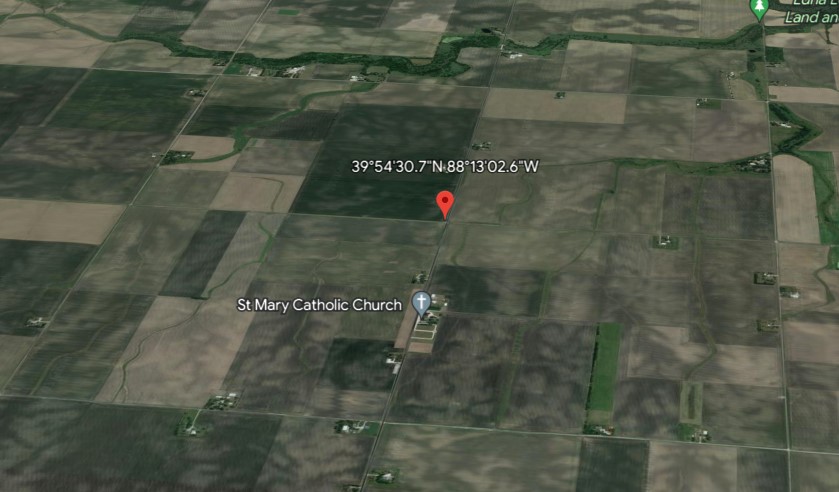
The pin in this instance was placed at the upper left of the northeast quarter of the township. In this case, the shape of the township can be discerned because of the farmland. Mr. Ohl purchased the western half of the northeast quarter.
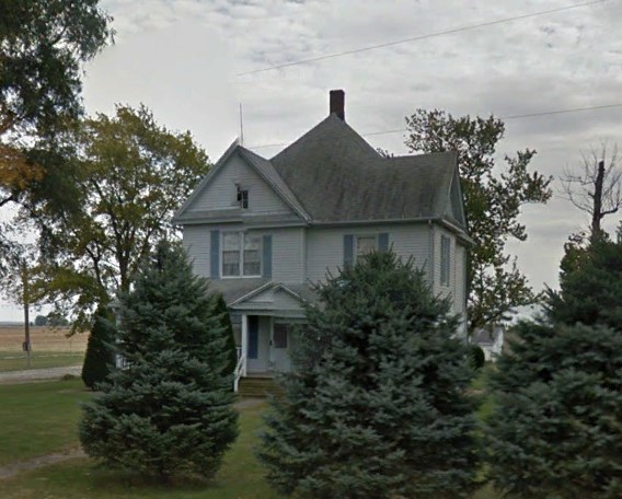
Although I do not know where Henry Ohl built his house, there is a house there at the bottom left next to St. Mary’s Catholic Church where he worshipped and where he is buried. This house appears to be quite old. Zooming in on Google Earth brings the house and church closer to view.
GOOGLE EARTH PRO
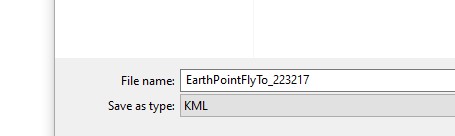
If you are using the Google Earth Pro software, you do not need to click View unless you want to see the coordinates. (Google Earth Pro can be found here as a free download: https://www.google.com/earth/versions/) Click Fly To On Google Earth. A Save As dialog box will open with a file name. Save the KML file anywhere on your computer – just remember where you saved it!
Go to the KML file and open it. I saved it to my desktop and double-clicked on it.

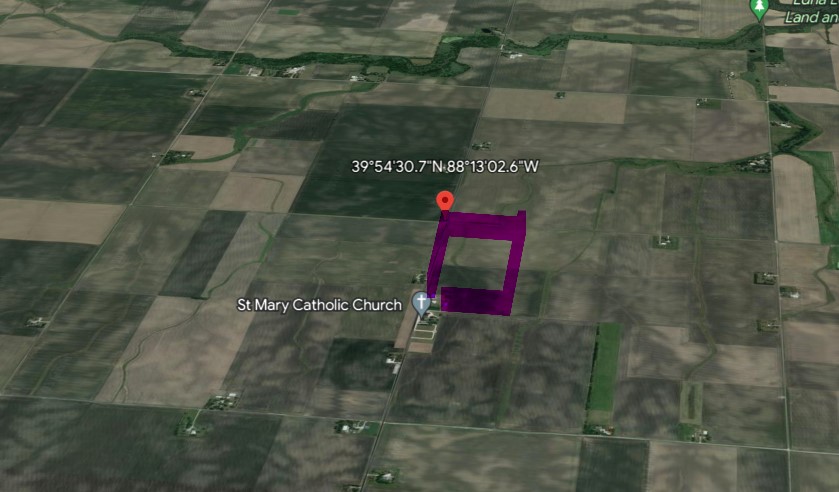
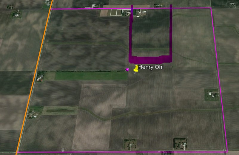
Google Earth Pro automatically opens and goes to the coordinates. In this instance, I have added a pin on Google Earth Pro showing the township in which my ancestor lived.

Google placed the pink dot in the center of the township, but he actually lived in the western half of the northeast corner.
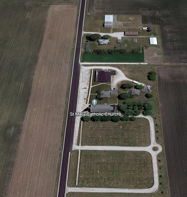
Here is a close-up shot of the house that is on the land he used to own in the 19th century and the church next door. I used street view for these pictures. (The orange and pink border lines still showed up in street view, as seen on the church picture.)

Of course, there are many more things that you can do on the Earth Point site, and I find this is a great tool for making your ancestors’ lives come alive.
