DAVID RUMSEY AND HIS MAPS

I love maps. All kinds of maps. Old maps from the days of “terra incognita” to modern-day Google street view maps. The calendar I used last year showed pictures of medieval and renaissance maps and I have a box (somewhere!) full of old gas station maps of various states with an emphasis on Colorado.
There are a few websites out there with maps. One favorite of genealogists is David Rumsey’s collection found at https://www.davidrumsey.com/. David Rumsey started collecting maps about 30 years ago and he has now acquired about 150,000 maps. At this point, about 105,000 have been digitized and made available to the public. Some of these images are included in Google Earth so that you can overlay an old map of a city on top of the current city.
These maps can be reproduced and transmitted but not for commercial use. There is a section titled “Copyright and Permissions” under the About tab to read when you first log in. For catching up with new additions or other news, there is a Blog tab. You can check out the Help tab to learn about the Luna Viewer and Georeferencing, among other topics.
The View by Collection tab has several choices. For this example, I chose “Browse by Categories”.

In the Search box, I typed Jefferson County Ohio. This brings up results that match to Jefferson and County and Ohio but since the search engine is searching the metadata, not all results will be for “Jefferson County Ohio.” You can also do an Advanced Search found on the left-hand side on the bottom of the Refine window after you do a search, or by clicking on the down arrow of the search bar on the upper right. There are many fields in which to choose if you use the Advanced Search and you may have to play with the fields to find exactly the criteria you need to find your desired map.
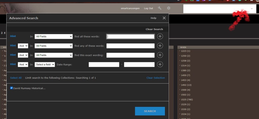
I chose the field “Full Title” and in the section “find all these words” I chose Ohio Jefferson. There were 13 results.
I specifically wanted to find a map of Jefferson County, Ohio around the year 1850 when my ancestors, George Lewis and Sarah Neal Lewis, lived there. I was able to find a map of the county from 1868 and I enlarged it to see the detail.
Here is the map that I found.
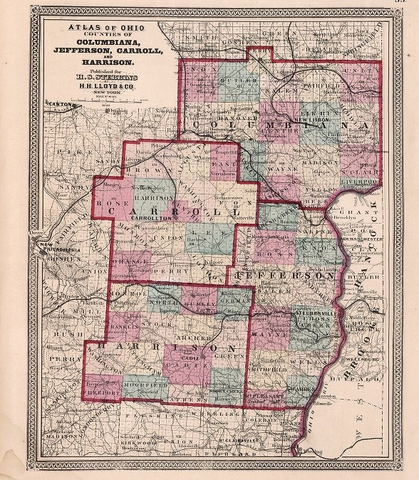
Henry Francis Walling, “Counties of Columbiana, Jefferson, Carroll, and Harrison”, David Rumsey Historical Map Collection (https://www.davidrumsey.com : accessed 9 February 2021), originally published by H.H. Lloyd & Co. for Henry S. Stebbins, New York, 1868.
And here is the map with a closeup of the section in which I am interested:
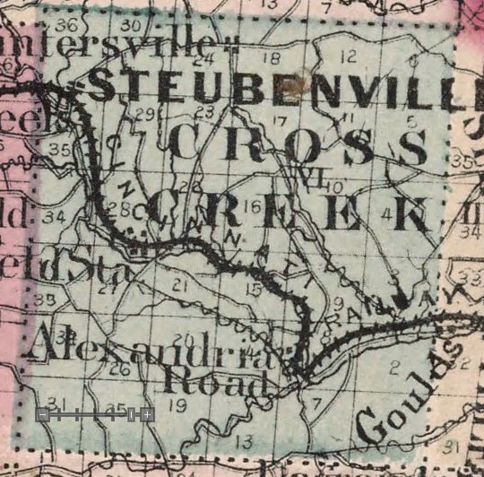
The detail is incredible when the map is enlarged. My ancestor’s family lived at the bottom of Cross Creek Township, near the Alexandria Road outside of New Alexandria which is not mentioned on this map.
You can also view this map in the GeoReferencer. This overlays the 1868 map over a modern map and you can vary the opacity to see the differences between the two maps.

Here is the same map overlaid with partial opacity on a modern map of Ohio:

I could stay on this website for hours, looking at maps of the world and the United States. Here is another that I found in the collection. This showed up in a search for Colorado, but the entire map encompasses Fort Worth to Cheyenne and Denver. This is a segment of the map.

Union Pacific Railroad Company, “Birdseye View of the Texas Pan Handle”, David Rumsey Historical Map Collection (https://www.davidrumsey.com : accessed 9 February 2021), originally published by Knight, Leonard & Co., Chicago, 1890.
Not all of the maps have to serve a genealogical purpose. I enjoyed this one:

The University of Arizona, Lunar and Planetary Laboratory, “Field Index, Rectified Lunar Atlas”, David Rumsey Historical Map Collection (https://www.davidrumsey.com : accessed 9 February 2021), originally published by the Aeronautical Chart and Information Center, United States Air Force, St. Louis, 1963.
Have fun checking out this site. I know that just writing this blog led me off on many tangents.
Search Smart,
Sara N. Martin
